

Day 2:
New Franklin to Jefferson City to Tebbetts 65 miles.
Highlights: Loose Limestone, Diana Bend Conservation Area, Hellacious Hills, Pulled Hamstring, Reunion

 Day 2 we awoke from our campsite around 9. The shade provided at campsite 12 allowed us to sleep in a bit longer than the usual tent slumber period. We went about at a slower pace, but surprisingly neither of us were sore from the day before. We made a hearty breakfast of eggs and beans in tortillas then made tuna pita sandwiches for lunch on the trail. We didn't actually hit the road until 11 and we still biked more than any other day.
Just outside of New Franklin was the most flat and barren of all the terrain we'd encountered thus far. The trail stretched for miles and with the area so flat you could see all of the nothingness. However as we neared the Missouri river the terrain did a complete 180. Rocks started to appear. Then bluffs. Then we were riding alongside a huge rock face on one side and swamps on the other. We had entered the Diana Bend Conservation Area.

The conservation area was beautiful. Probably the most beautiful scenery on the whole trail - though my opinion could have been colored by the strong juxtaposition with area around New Franklin. It was here that we saw buzzards living in the bluffs circling the swamps, harks soaring through the air, and our first trail snake! Bum Bum BUMMM!
My wife hates snakes, but they are quite common on the trail. The first one we encountered was just off the trail, but we ran into a couple sunning right in the middle. Mostly they were black in color and likely non-poisonous, mostly.


We couldn't linger long in Rocheport. We had to meet up with our friends. You see there was a few snags in our initial plans. One of those was that St. Louis' Amtrak could only transport 4 bikes at a time, really not enough room for that; -1 for Amtrak. We reserved our seats ahead of time along with 2 other women who boarded the train just outside of the city. So our St. Louis traveling companions could not board with us. Because of this, my wife and I spent the first day by ourselves. On the second day they got on the same train from St. Louis, but only took it to Jefferson City. Being further east, they arrived at 11:30, got lunch, and headed on the trail west while we headed east.
The original locomotive line must have been carved into the cliffs in this area as the trail was wedged between the rock face and the river. I wasn't complaining. The ground was quite flat, the limestone quite compact, and there was always something to look at. We passed through the riverside shanty town of McBane. As usual the trailhead history charts proclaimed this settlement as a former railroad boom town now in decline since it shutdown. It's only claim to fame now is a water refinery whose artificial levee made it one of the few places that didn't flood in 1993. As I understand it they call that *the* flood or the great flood.


Around 4 o'clock the clouds rolled in. A strong head wind hit us and the sound of distant thunder could be heard. It was at this time that I really noticed the utter flatness of Missouri. Louisiana is flat and all but Missouri's stretching nothingness allowed us to see for miles. The iPhone radar said the rain was passing very south of us, but I swear I could see it hitting some areas within our view.
We pulled in to Hartsburg. You might guess it was a quaint little town with bed and breakfasts and eateries - Dotty's has got all you need - but the camping there is just a city park. They'll let you camp but a fire or facilities is questionable.

What's that up ahead? Could it be? Our friends Marty and Nicole on their twin Long Haul Truckers coming down the road! They had been biking east out of the capital, Jefferson City. After lunch, and a meeting with their local congressman, we met up here in Hartsburg.
 These guys gave us a second wind that carried us through the rest of the long day. We found ourselves 10 miles down the road at N. Jefferson. I don't know if North Jefferson is a town proper or just an area near Jefferson City much like New Franklin was to Franklin. What I do know is that our arrival into Jefferson City started the beginning of what turned out to be the most miserable night of the trip.
I'm sure Jefferson City is a lovely town, but goddamn those hills! The city proper is only 5 miles off the trail, but first is this gigantic gangplank to reach the bridge. You must spiral around 5 ramps before reaching the crossing.

Once you do make it over the bridge you are met with a busy intersection and a total loss of bike lane. Taking a left past 2 roads of traffic fully loaded, we then plummeted down a huge hill to be dropped off at the bottom of a equally steep hill this time ascending.
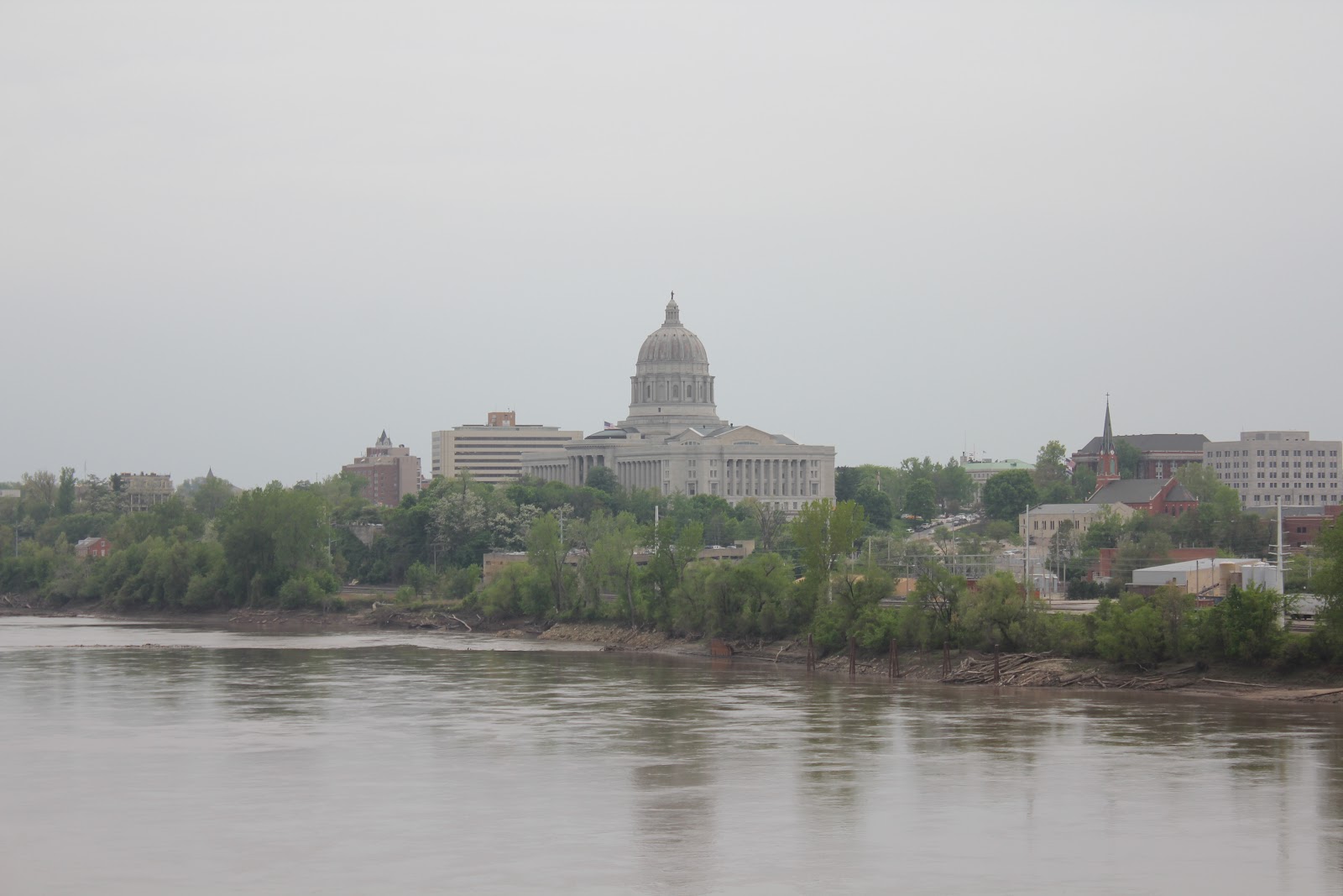
This new hill faced the capital building, which was gorgeous. Puritan preacher, John Winthrop's "city on a hill" allusions were not lost on the good people of Missiouri. We continued to climb; past the capital building, past other government facilities, past Chim's Thai Restaurant - hey! - until we met up with our new friend Dana Gray.
We didn't arrive in North Jefferson until 5 or 6 and making our way through the hellish capital hills we met her at a pub 30 minutes later. A few moments after we arrived, the rain started. The food was just ok, but we were all thankful to have drinks that were cold and wet and to be somewhere warm and dry.
 Perhaps what followed was our fault. Our merry-making might have lasted too long. The number of pints quaffed might have been too many, but we left that town close to 7:30 and didn't hit the trail until well after dark. Our destination for that evening was Tebbetts. There is a fantastic bike hostel there with bunk beds and showers for an honor donation of $5 per person per night. It was about 10 to 12 miles away from N. Jefferson. If you think we were cramming too much into one day I think you are correct.
So it was raining. It was dark. Real dark. Missouri dark. Clouds and rain and nothing else. We had at least an hour ride. It was at this point that I started to feel a strain in my leg. While riding those hills through the capital city I had pulled something - hard. It would bother me for the rest of the trail and slow us down considerably.
I won't tell you about how we made it. I won't tell you about the noctural night life on the trail. I won't tell you about the conditions of the hostel. Just reliving this day has tired me. No, I shall save those stories for another day.


